
translate geophysics to english - pseudosection
Making geophysical concepts clearer for better exploration decisions.
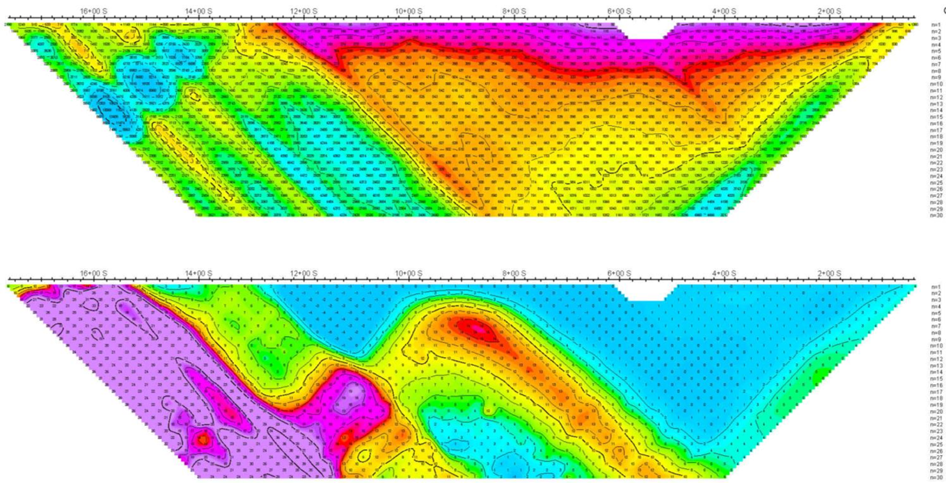
A pseudosection is a conventional 2DIP representation that shows how a geophysical property appears to vary along a survey line, plotted using electrode spacing (n value) rather than true depth. Generated from surface or borehole data, it helps visualize subsurface patterns in a way similar to a cross-section, but based on measured resistivity and chargeability responses rather than direct observation. It is a practical tool for identifying anomalies and a convenient way to assess the data in the early stages of interpretation.
for humorous purposes only, not affiliated with Google


