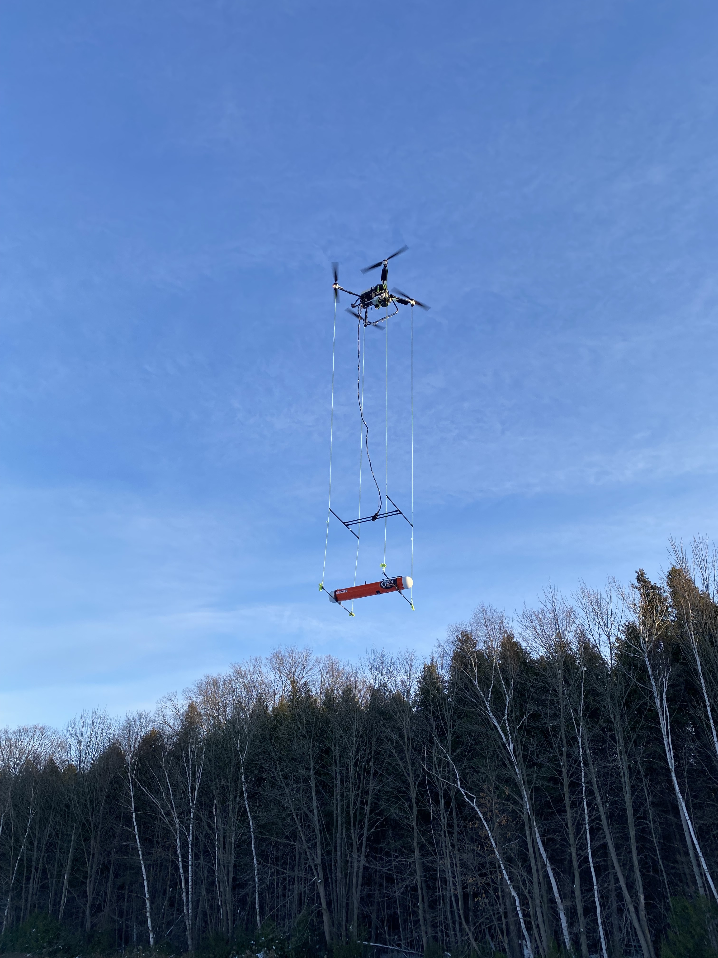
AeroVision UAV survey – Drone MAG, LiDAR, and Imagery
AeroVision airborne geophysics technology offers low altitude surveying while acquiring high-resolution magnetic, LiDAR and imagery/videography data at regular intervals for a fraction of the cost of the ground surveys. Its on-board collision avoidance system is integrated with the data acquisition and navigation systems to fly a low-level constant terrain clearance survey (of 5 m), while avoiding the occasional obstacle (tall tree) since the drone will detect the obstacle and automatically fly over it. It is real-time QC monitoring of data and navigation system.
AeroVision is a proven geophysical prospecting and mapping method that has flown thousands of line km’s. It is the best solution for performing near surface MAG, LiDAR and imagery/videography surveys in remote environments. The low flight altitude reduces near surface noise while maintaining a high resolution and a smooth and consistent coverage which helps to create accurate 3D inversion models.
-
10x faster - Acquisition 10 times faster with aeromagnetic survey.
-
Quality - Maintains a spatial resolution of 1 m and remains low to the ground at a lower cost than surface data.
-
Efficiency - No line cutting required, low altitude flight, and maximizes smooth flight path in the presence of obstacles.
Case study: Orogenic Gold Deposit – Enhancing geological insight through Drone-MAG data - Barrick Gold – Hemlo Mine, Ontario, Canada
Learn about our magnetics survey offerings or contact us for a custom quote.