AeroVision UAV survey – for drone MAG, LiDAR, and Imagery
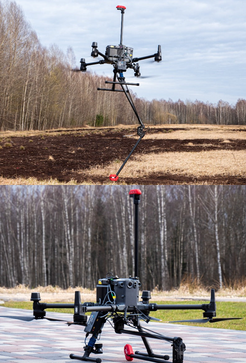
AeroVision offers low-altitude surveying with high-resolution magnetic (MAG) data acquisition at regular intervals, providing a cost-effective alternative to ground surveys. The system uses onboard collision avoidance and terrain-following technology to maintain a constant clearance of 5 meters or less, safely avoiding obstacles like tall trees. If the sensor contacts the ground or an obstacle, it does not cause a crash—vital for low-altitude flights.
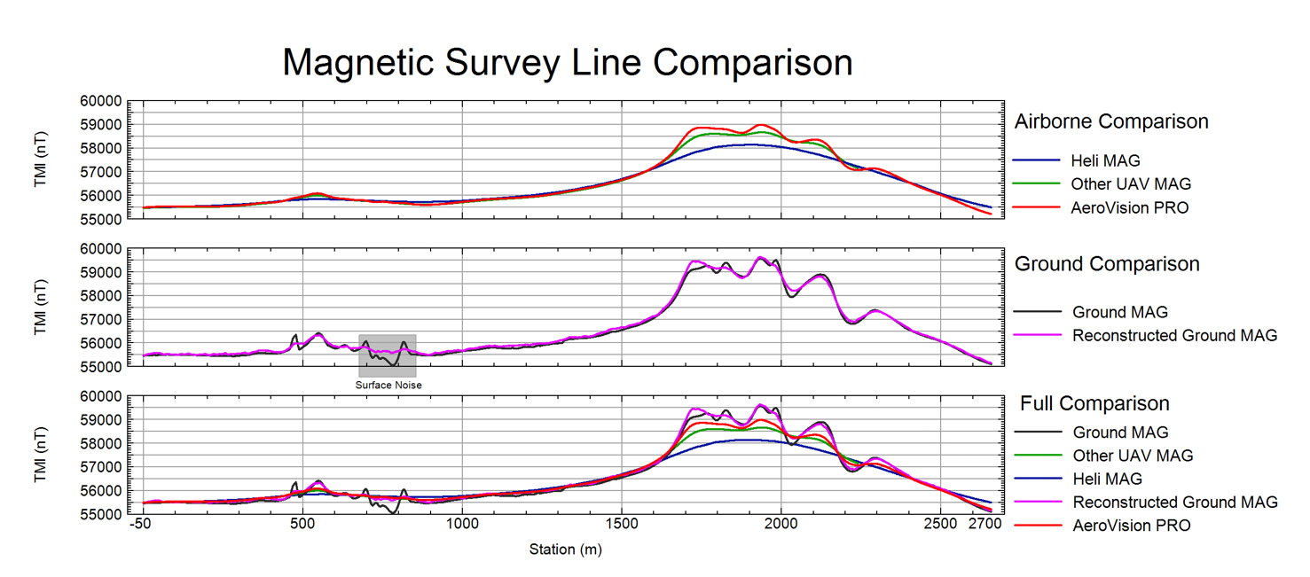
Real-time quality control (QC) of the navigation, along with live mission recording and AI spot checks, ensures precise flight patterns and reliable data. The higher altitude of the sensors compared to ground surveys reduces the influence of near-surface noise, while still maintaining high resolution and consistent coverage. This improves the quality of 3D inversion models.
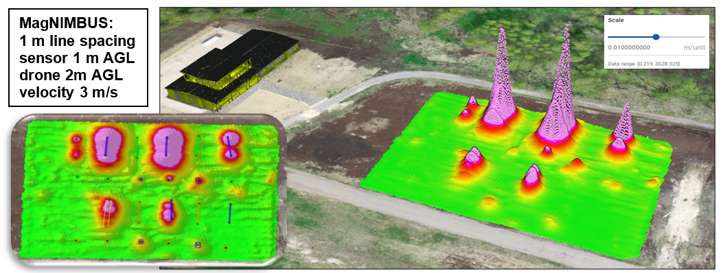
It also acquires data in a vertical gradient configuration, essential for constructing a ground equivalent dataset. Take a look at this survey line comparison. With AeroVision’s vertical gradient-derived ground magnetic data, we can effectively eliminate unwanted surface noise typically seen in ground surveys, while still maintaining the desired resolution that it brings, providing clearer and more accurate magnetic maps.
Our drones are designed to operate in harsh environments and can handle winds up to 12 m/s (43 km/h). The highly sensitive, lightweight total-field magnetic sensor records at 1000 samples per second, providing extreme accuracy and stability.
Abitibi Geophysics also offer Beyond Visual Line of Sight (BVLOS) operations.
Key characteristics of the AeroVision system include:
- Ultra-low surface-to-sensor flights, only centimeters above ground, at lower cost than ground surveys.
- Flight speed of approximately 8 meters per second.
- DJI Matrice M350 multirotor UAV platform with a collision avoidance system.
- Maximum flight time of 55 minutes without payload; 45 minutes with full payload.
- Operating temperature range of -15° to 50° C (drone + magnetometer).
- DJI O3 Enterprise Transmission supporting triple-channel 1080p HD live feeds, with a maximum range of 20 km.
- MagNIMBUS magnetometer with QuSpin Gen-2 Sensor, available in single- sensor or vertical gradiometer configurations.
- Rigid, self-foldable mounting system.
- Low altitude flight above ground, trees, and other obstacles.
- Real-time quality control of magnetic data and navigation, live mission recording, and AI spot checks for precise flight patterns and reliable data.
As an optional enhancement to our advanced drone-mag interpretation, Abitibi Geophysics offers Centre for Exploration Targeting (CET) analysis—a predictive, knowledge-free method that identifies structural complexity, magnetic discontinuities, and prospective zones for mineral deposits.
Case study: Orogenic Gold Deposit – Enhancing geological insight through drone MAG data - Barrick Gold – Hemlo Mine, Ontario, Canada
Learn about our magnetics survey offerings or contact us for a custom quote.